Homes
Housing conditions in the Ward contrasted starkly with those in the rest of the city. Due to the steady influx of immigrants into the neighborhood, there was a housing shortage: residents lived tightly packed in boarding houses and in alley houses tucked in the narrow lanes between buildings. The boundary between work and home was blurry, and commercial goods further cluttered the scene. In this way, the neighborhood exuded a similar atmosphere to Old World villages and shtetls, and its vibrant outdoor life was a source of solace for its inhabitants.
Establishment Torontonians, however, associated filth with moral decay and viewed these overcrowded and impoverished housing conditions as imminent moral and public health crises. The government commissioned reports and documentary photography to provide evidence of dangerous slum-like conditions: the 1911 Hastings Report, for example, expressed fears that unless housing in the Ward was reformed "the consequent increase of crime and immorality will prove very expensive to the city."
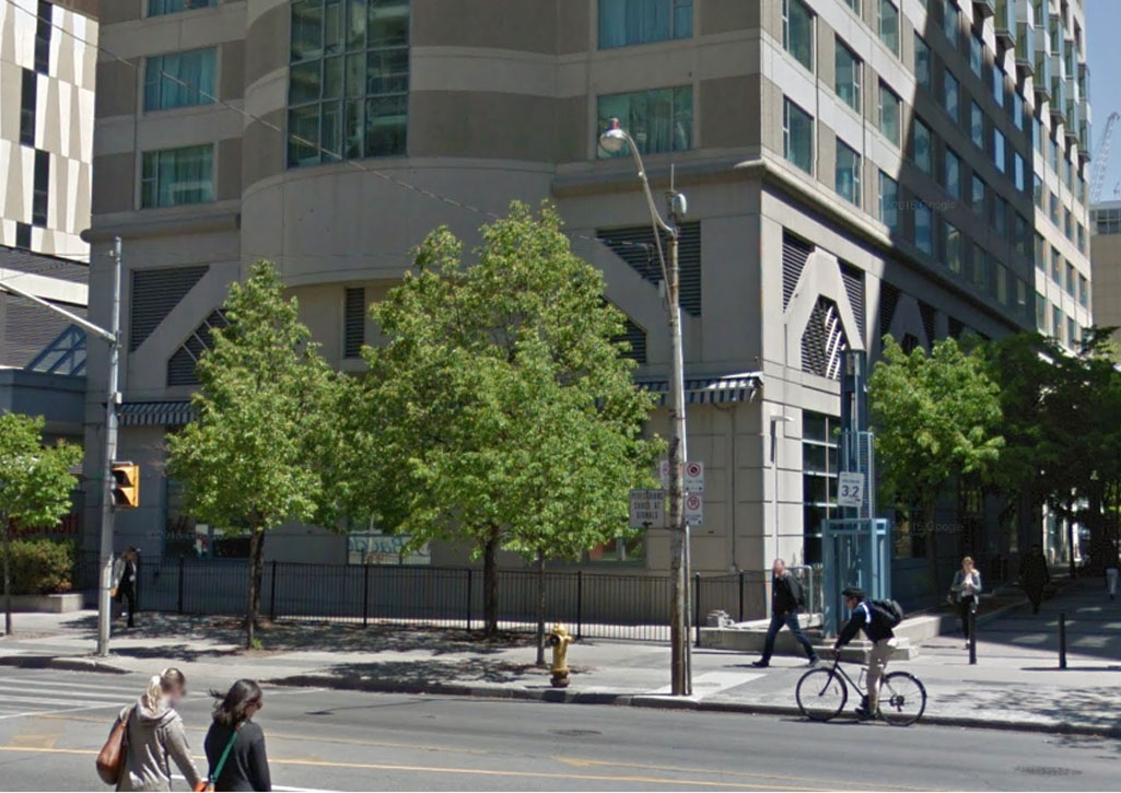
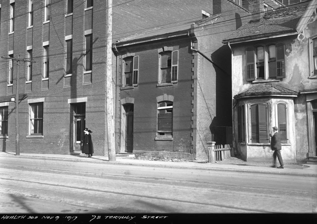
75 Terauly/Bay Street, 1917
Left: City of Toronto Archives, Series 372, Subseries 32, Item 545
Right: Modern image from Google Street View
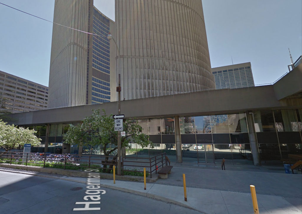
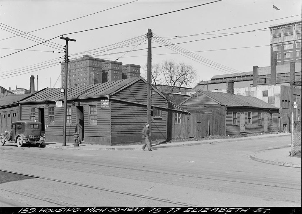
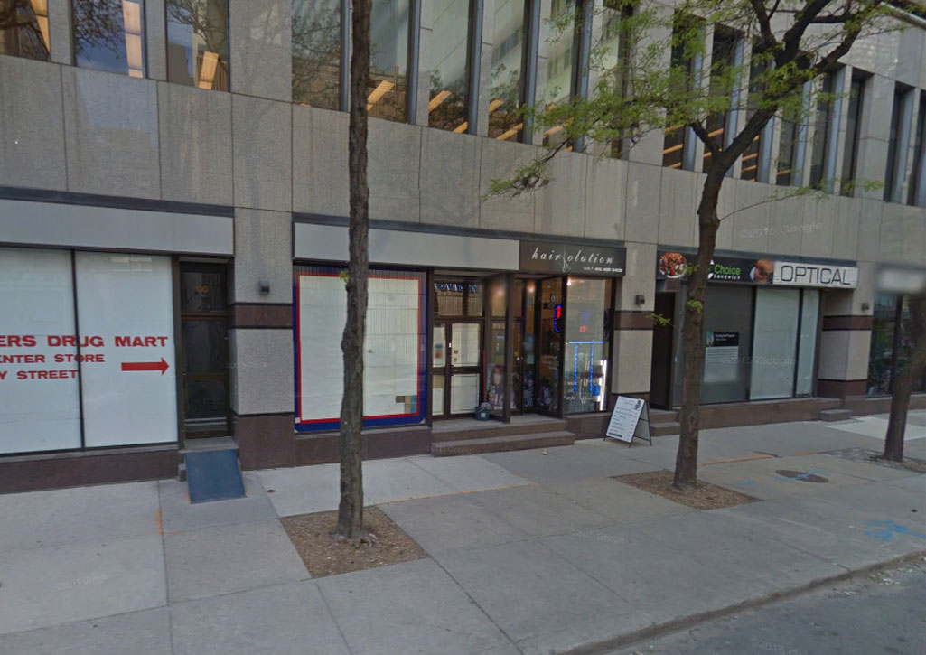
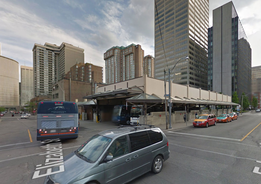
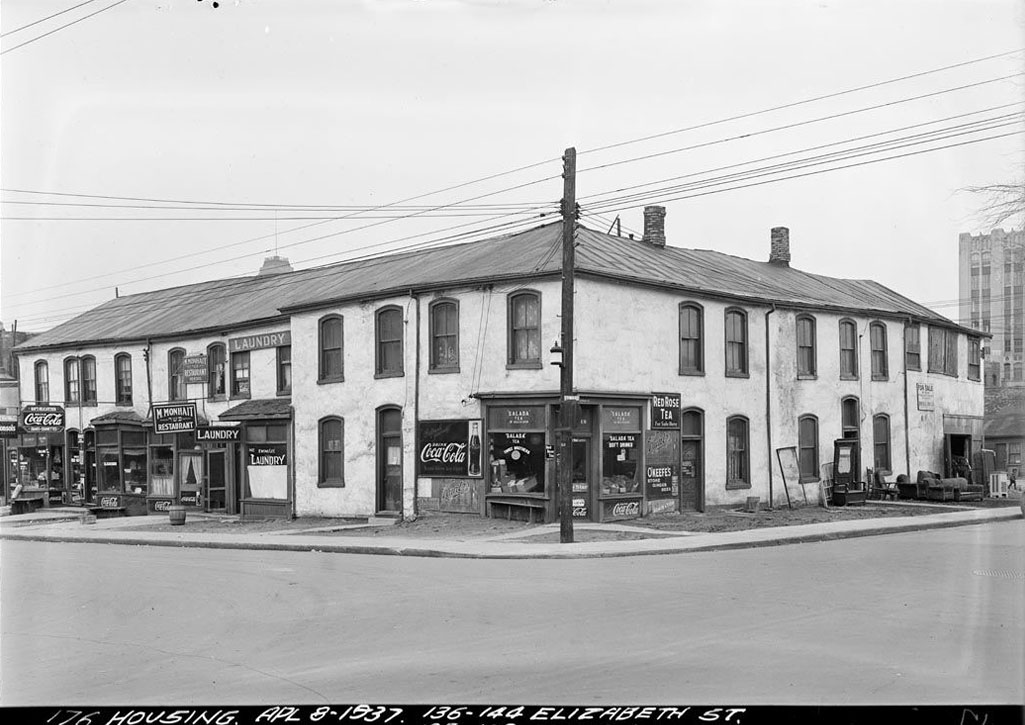
SE Corner Elizabeth and Hagerman, 1937
Left: City of Toronto Archives, Series 372, Subseries 33, Item 159
Right: Modern image from Google Street View
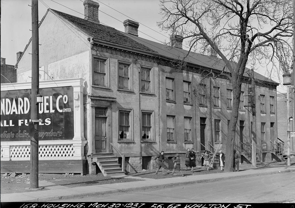
Walton Street, 1937
Left: City of Toronto Archives, Series 372, Subseries 33, Item 168
Right: Modern image from Google Street View
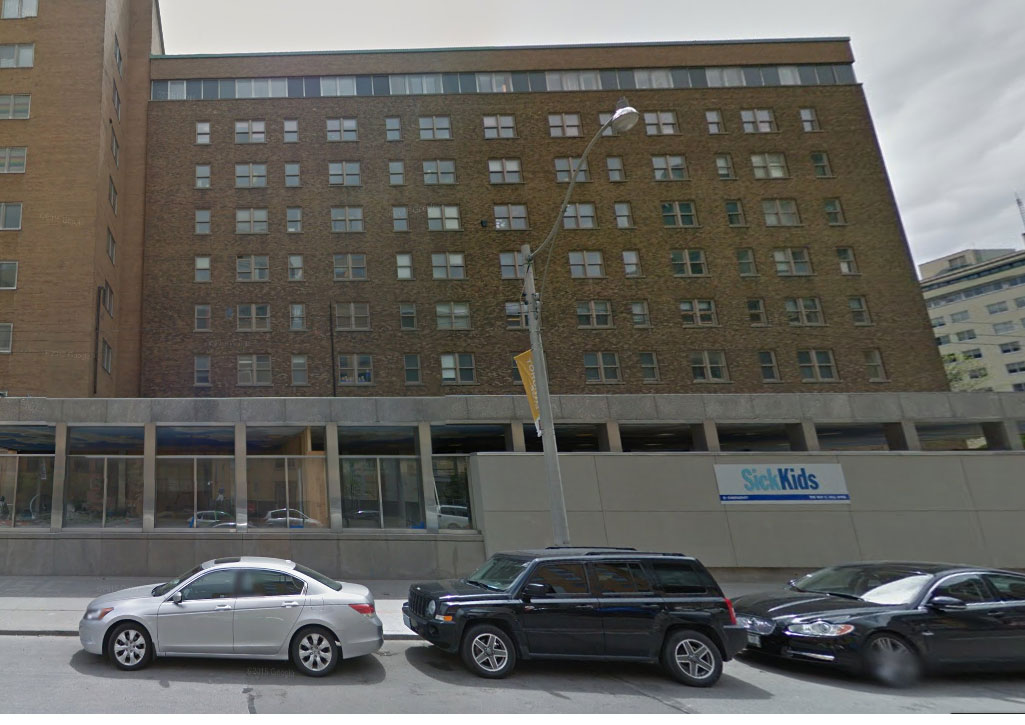
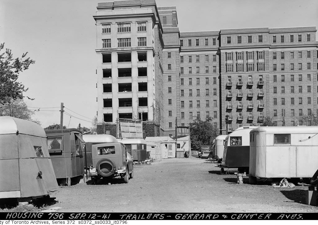
Gerrard and Centre, 1941
Left:City of Toronto Archives 372, Subseries 33, Item 796
Right: Modern image from Google Street View
Businesses
Jewish, Italian, and Chinese immigrants often traveled to Toronto in search of work: many came with the intention of returning home after saving up and sending back their pay.
Men initially found work in construction, peddling, and in the garment industry, particularly at the nearby Eaton's factory. Eventually, many became small business owners: Italian groceries, Chinese laundries and restaurants, and Jewish general stores were common. Women in the Ward worked alongside men in factories like Eaton's, and often brought in supplementary income from domestic industries, taking on boarders and running speakeasies.
Jewish and Italian immigrants in particular brought traditions of unionization with them, and the Ward developed a reputation for worker militancy. Anarchist, Trotskyist, and other radical labour organizations abounded, and the Ward was host to some of the largest and most significant strikes in Toronto's history such as the 1912 Eaton's Strike, the 1931 Garment Workers' Strike, and the 1933 Anti-Fascist strike.
SW Corner Edward and Elizabeth Street, 1937
Left: City of Toronto Archives, Series 372, Subseries 33, Item 176
Right: Modern image from Google Street View
Agnes Street, 1910
Left: City of Toronto Archives, Fonds 1244, Item 291
Right: Modern image from Google Street View
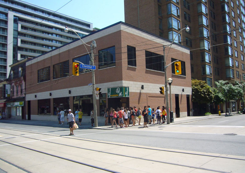
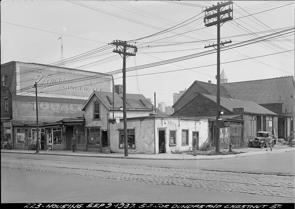
SE Corner Dundas W. and Chestnut, 1937
Left: City of Toronto Archives, Series 372, Subseries 33, Item 223
Right: Modern image from Google Street View
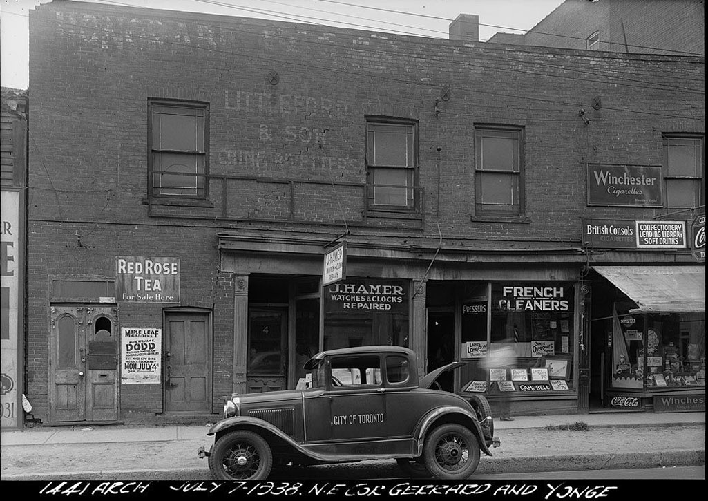
NE Corner Gerrard and Yonge, 1938
Left:City of Toronto Archives, Series 373, Subseries 1, Item 1441
Right: Modern image from Google Street View
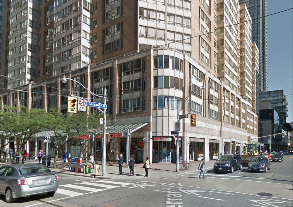
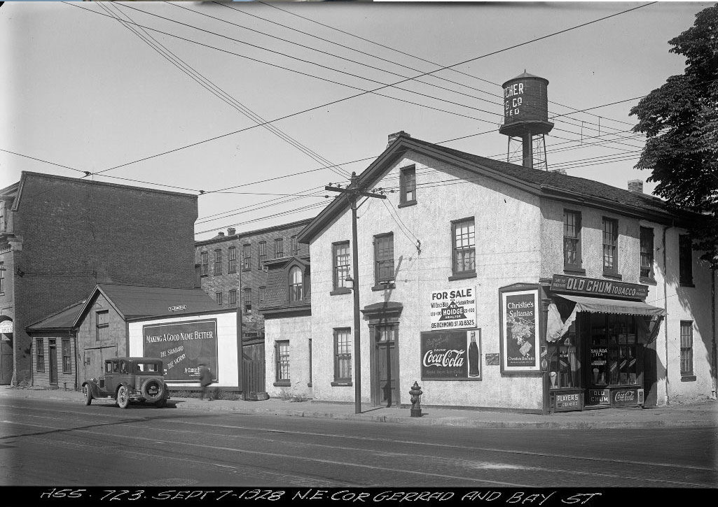
NE Corner Gerrard and Bay, 1928
Left: City of Toronto Archives, Series 372, Subseries 3, Item 723
Right: Modern image from Google Street View
Landmarks
In the 1950s much of the population living in The Ward was relocated to make way for new city hall. Today there are very few traces of the original neighbourhood left since there are only a handful of buildings still standing. A few landmarks are often the only shared urban memories many contemporary individuals would have with the people that once lived and worked in the neighbourhood.
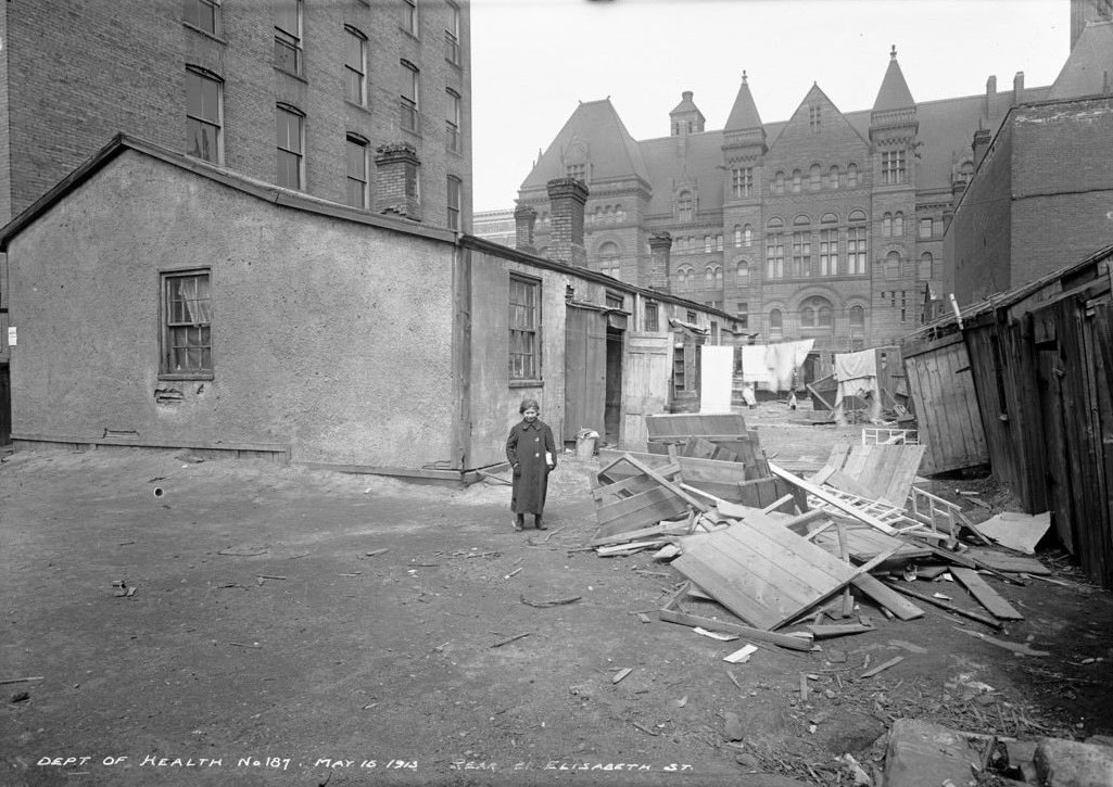
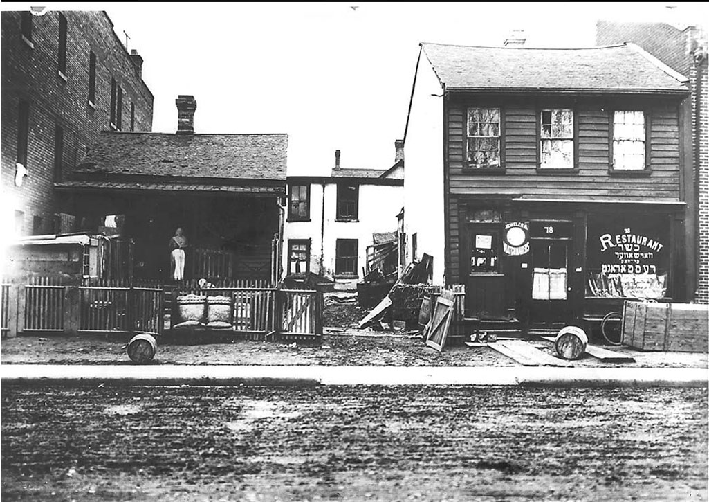
Rear, 21 Elizabeth Street, 1913
Left: City of Toronto Archives, Series 372, Subseries 32, Item 187
Right: Modern image from Google Street View